Using Facebook Population Density Data in QGIS
Download the data
Download the data
All the datasets can be download on HDX. Search for the country you want and download the zip file.
In QGIS
Open the raster file in QGIS.

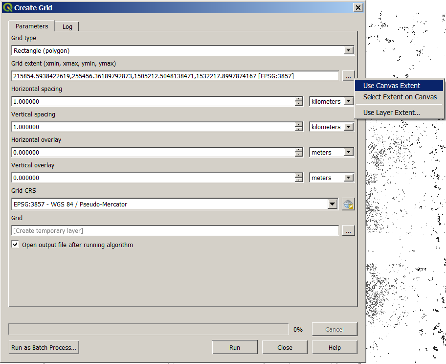
Open the tool Create Grid.

Set the parameters:
- Grid type: Rectangle.
- Grid extent: Use Canvas Extent (to use the same extent as the current view) or Use Layer Extent (and select the population raster to use the full extent).
- Horizontal and Vertical spacing: Choose here the size of each rectangle. In the example, we set it to one kilometer to have a grid of one kilometer square.
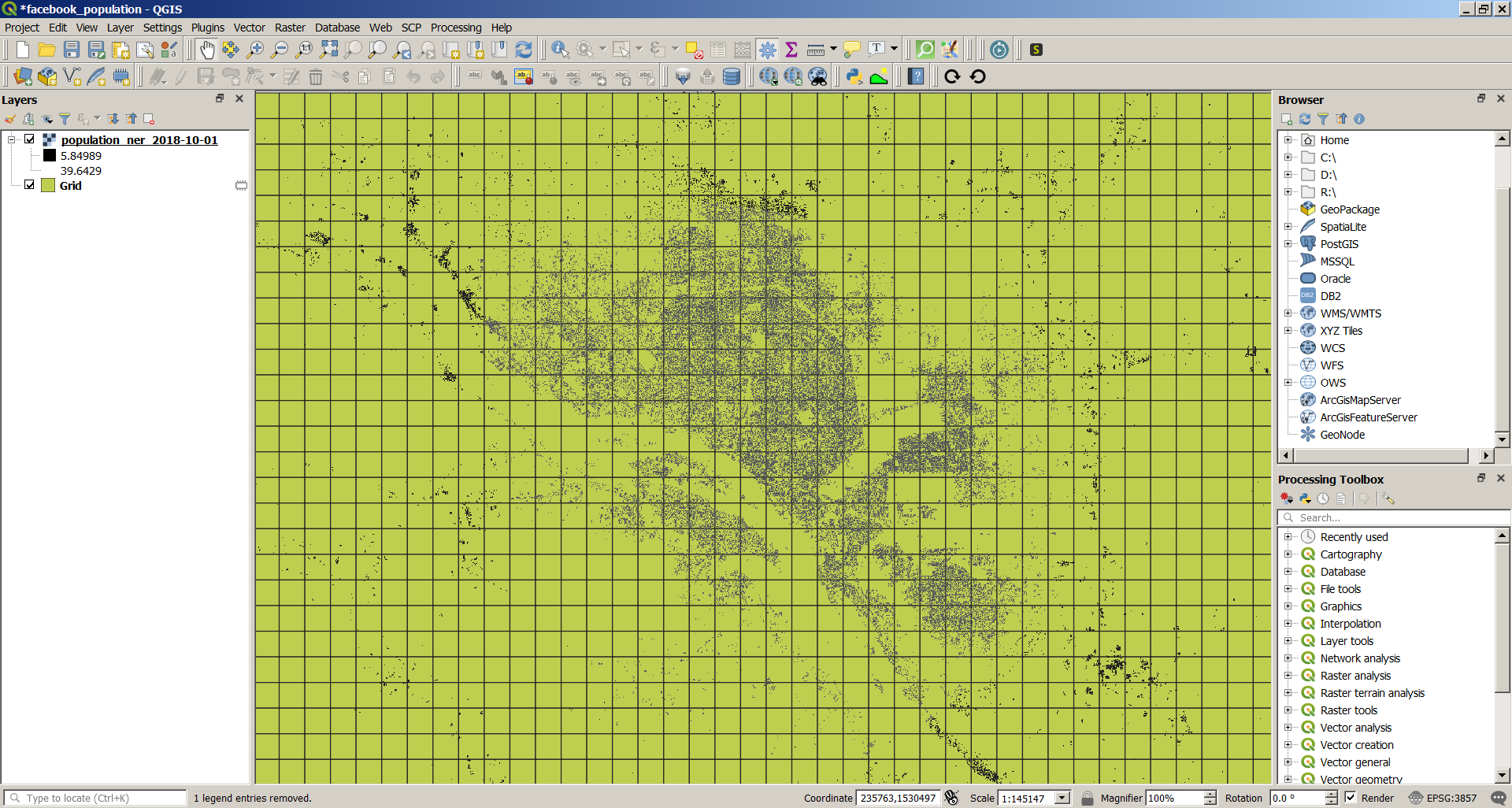
Result:
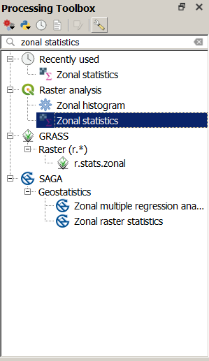
In the Toolbox, search for the tool called Zonal Statistics.
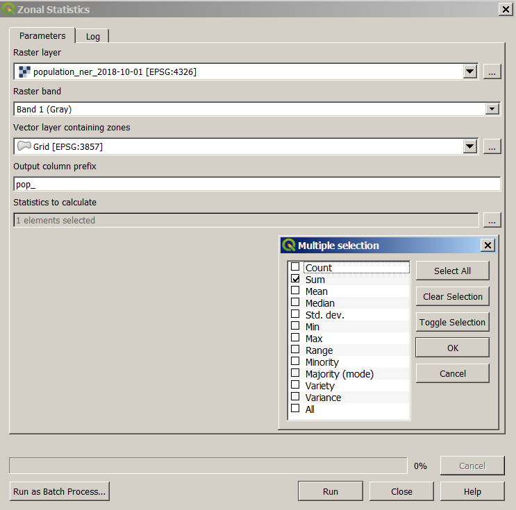
Set the parameters:
- Raster layer: Select the population raster layer.
- Vector layer containing zones: Select the grid.
- Output column prefix: Type pop_.
- Statistics to calculate: Tick only Sum.
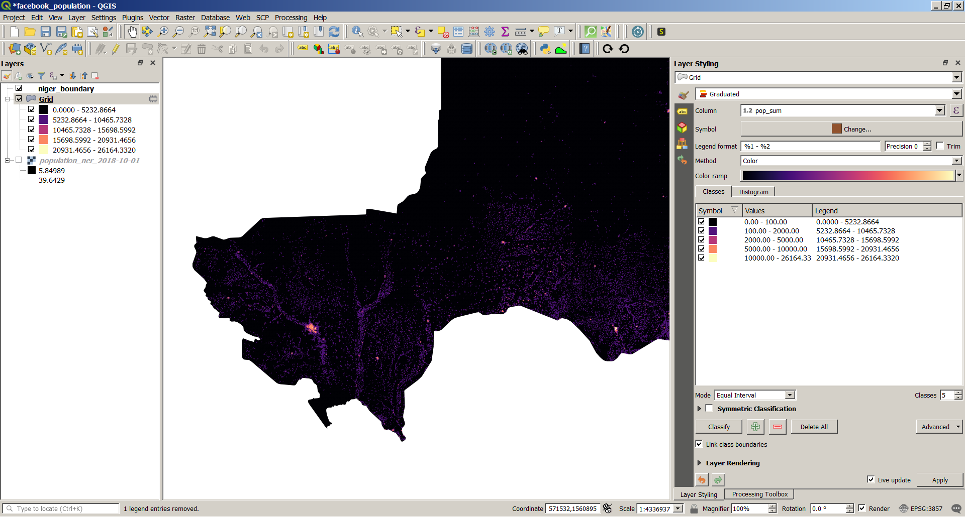
The tool will create a new column in the attribute table of the grid with the population by square (of one kilometer square in this example).

Use a Graduated symbology to style the layer.
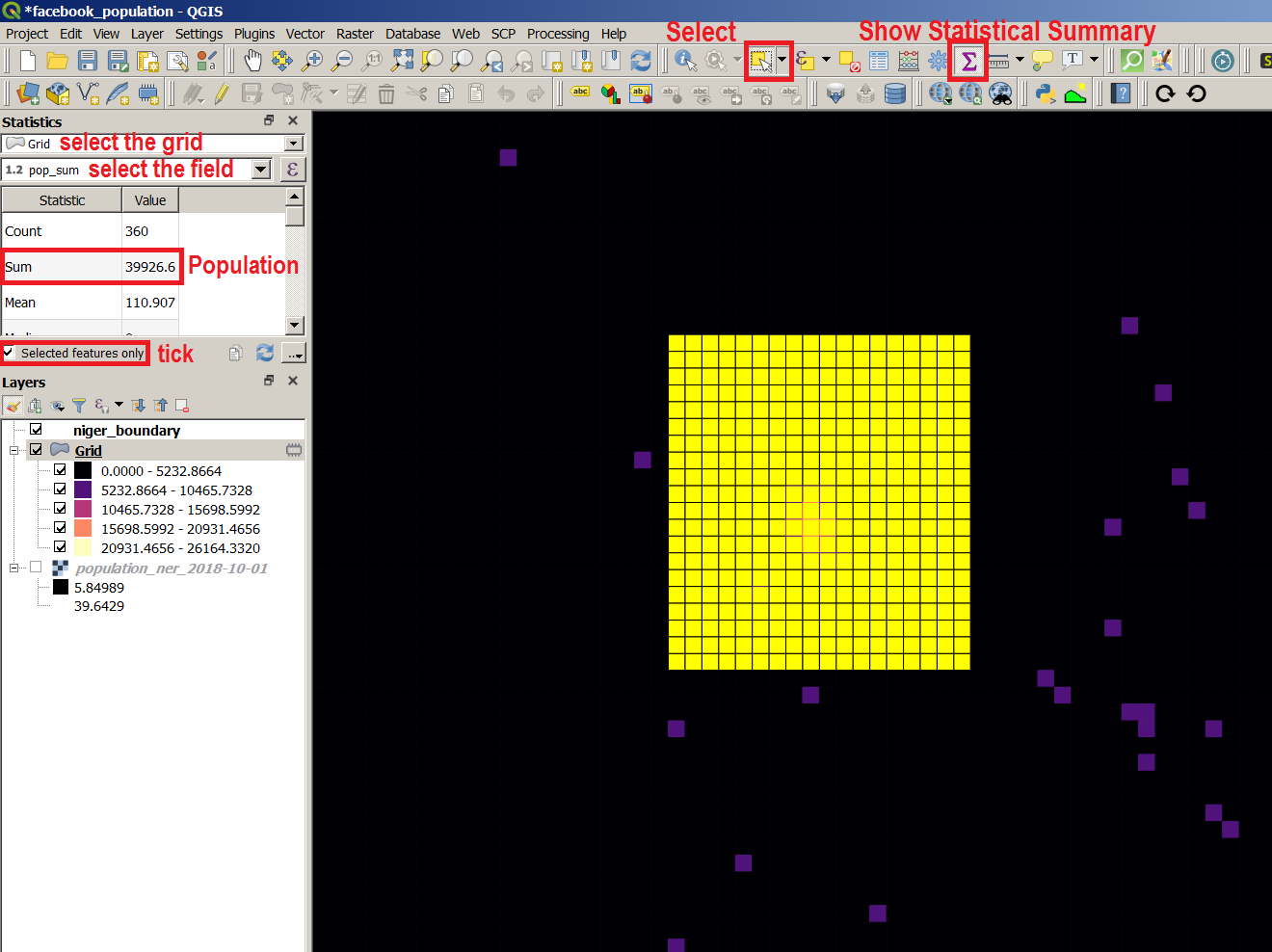
If you want to estimate the population of a specific area, select the corresponding squares of the grid and use Show Statistical Summary.
You can also use a layer of administrative boundaries (regions, districts, neighborhoods etc.) instead of the grid to compute the population for each using the Zonal Statistics tool.